
About Kvitsøy VTS
Kvitsøy Vessel Traffic Service (VTS) Centre is a vessel traffic service and pilot dispatch station situated on the island municipality of Kvitsøy in Norway.
Mission of the VTS: Ensure safe and efficient shipping and minimise risk of accidents.
Some statistics from 2018:
- 155,059 sailing clearances
- 217 events registered
- 24 reporting vessels with engine shutdown or engine problems
- 13 corrected navigation errors
- 22 Anchor dragging – 8 of these were gas / oil tankers
Test Mission
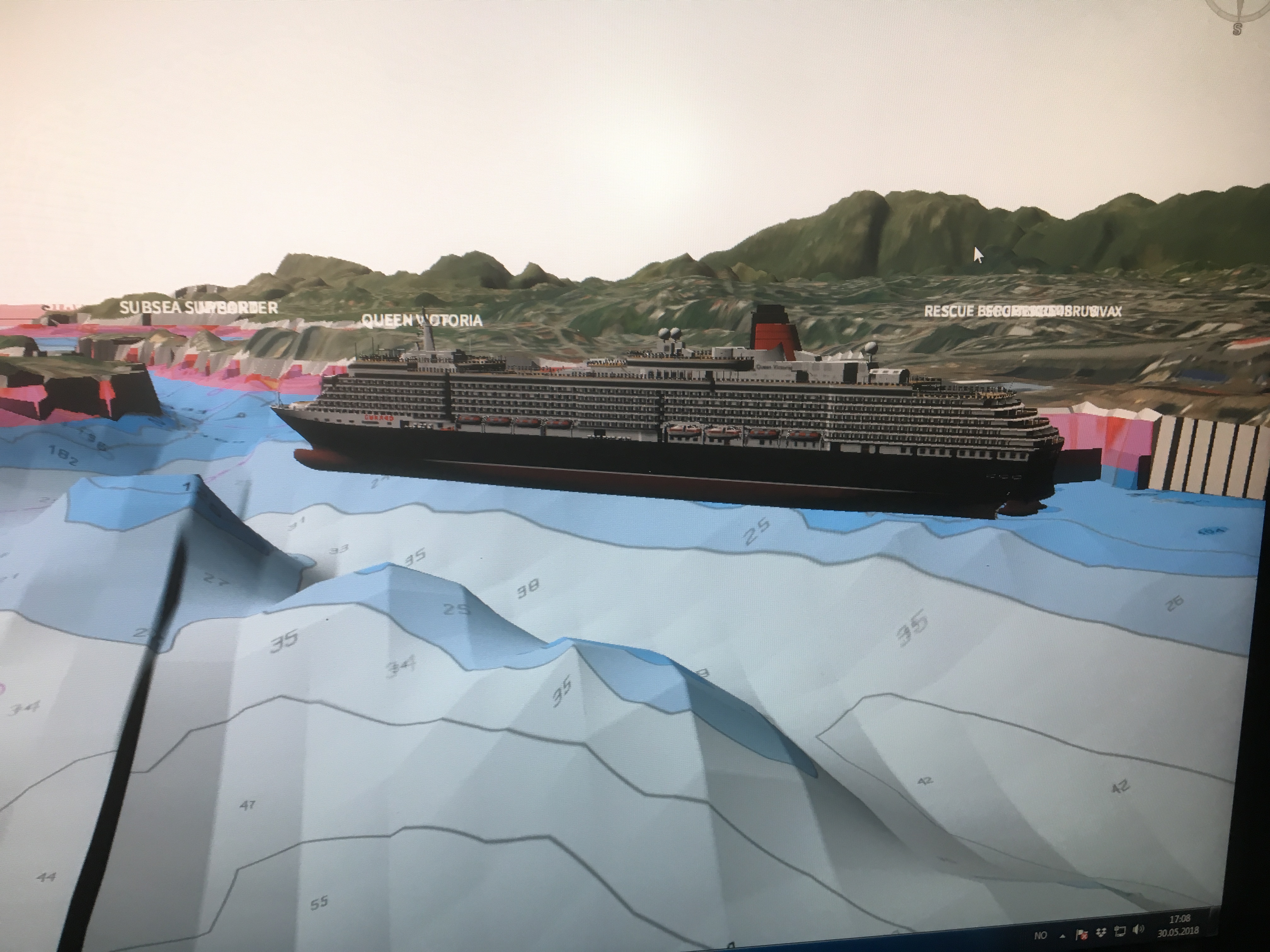
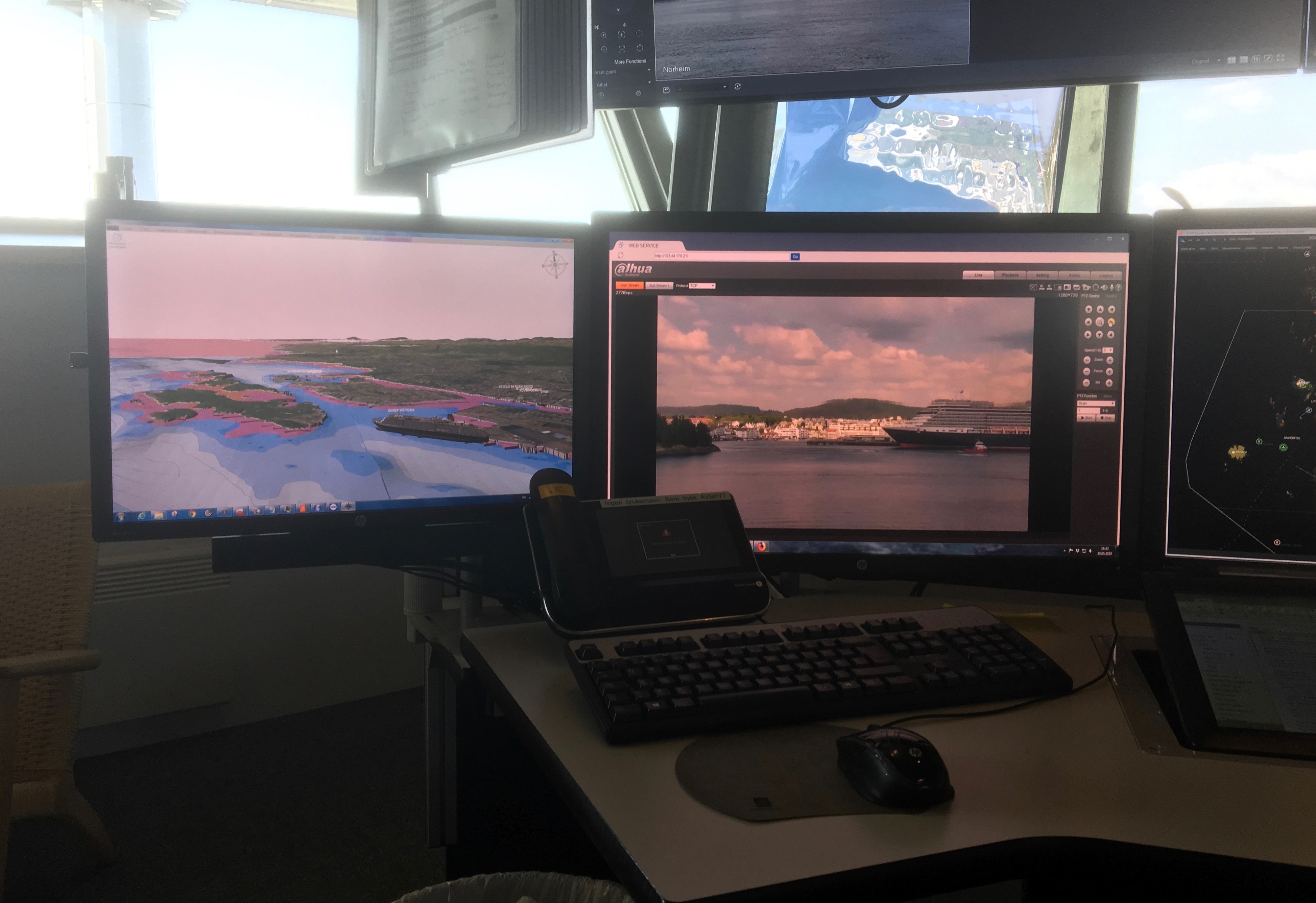
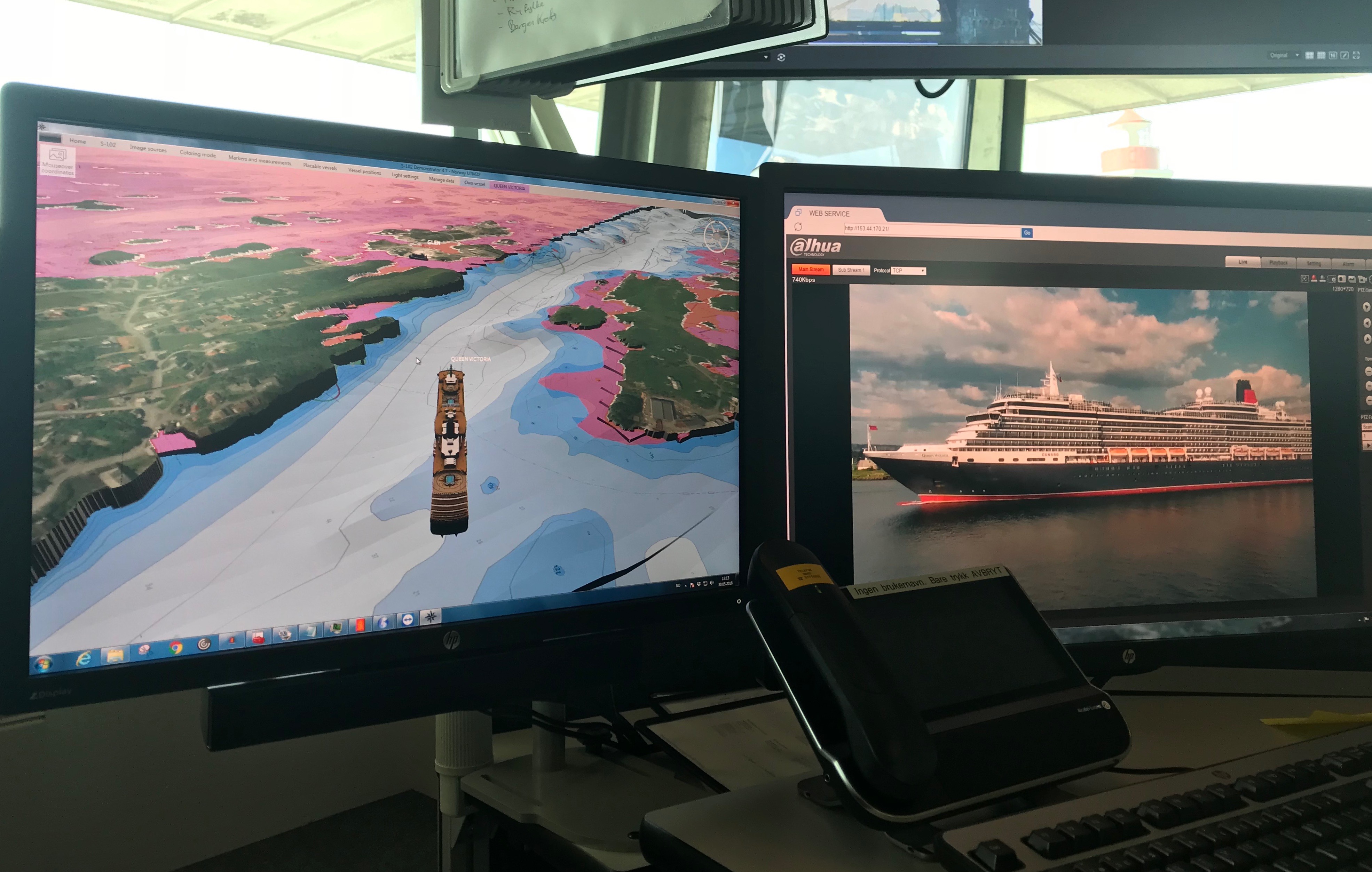
Observing from the VTS station at Kvitsøy, the participants followed the MS Queen Victoria’s departure from Haugesund through the Osnesgavelen and Skårerenna.
Test execution
- Date of test: 30/05/2018
- Responsible tester: Asle Njaastad (VTS Officer)
- S-102 Demonstrator Version: 4.7 (early version)
- Weather Conditions: Still weather, approx. 25°C
Dataset used
NOROGAL01
Layers/Charts
ESRI and S-57
Chart system
C-Scope

Results
Functionalities used & regarded as the most useful during the test:
- AIS with the correct model view, follow, height multiplier and pan functions in the map view.
- Being able to see the vessel from all angles was the most important feature for the type of voyage undertaken.
Experience from the test
Being able to follow the vessels voyage in 3D map increases sea safety in this area. With the aid of the S-102 demonstrator, the officer has the opportunity to anticipate hazards that can arise and thus inform the vessel before it can occur, for example the distance under the keel in relation to depth and distance laterally to any hazards. The demonstrator is also a very good tool to identify safe anchor positions for vessels wishing to drop anchor.
Additional requested functionalities
It would be good to have the possibility to see the shadow of the vessel on the bottom and as such have the ability to estimate the position where the vessel was “on the bottom”
(ECC Comment: The requested functionality was implemented in version 5.0 of the S-102 Demonstrator)
Evaluation – Value potential
Based on the presented statistics for 2018, “anchor dragging” is a significant problem and involves great environmental risk. By using the S-102 data in the planning phase of anchoring, the risk of “dragging” could potentially be reduced.
It would be very beneficial for the VTS Centres to have access to S-102 datasets for all the common anchoring and port areas for which they are responsible.
