S-102 Datasets and dataformat
The project focused on the Norwegian coast, and several areas were selected as AOI (Areas Of Interest) for operational test purposes.

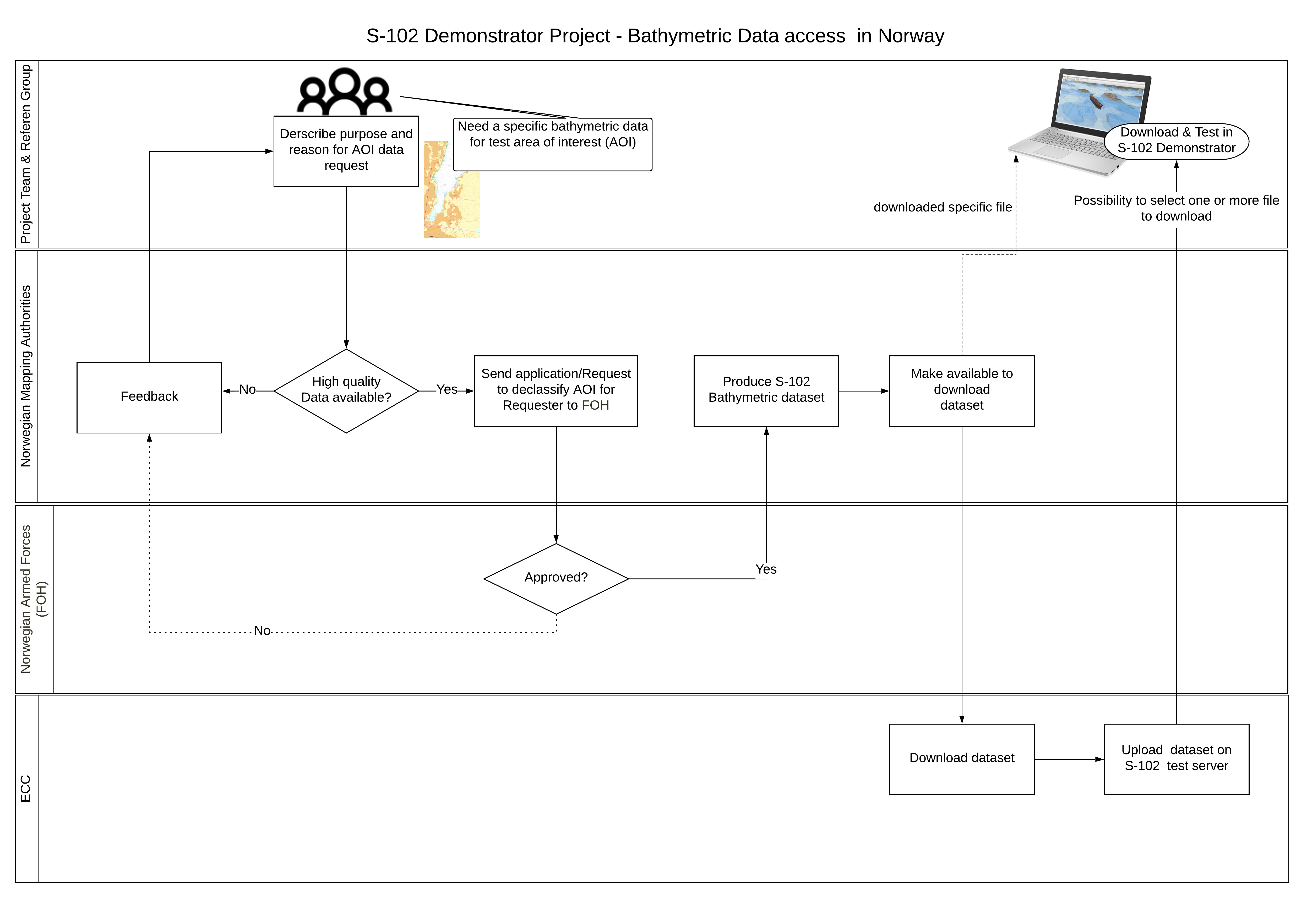
Data with the required resolution and quality are not readily available for all areas and are also restricted by military security classification. Data with resolution of less than 50×50 m are considered confidential by law.
In order to get high resolution data for these areas, several steps had to be taken.
- Define and specify reason and purpose for the requested data.
- Analyse high resolution data availability for the AOI.
- Send requests to the Norwegian Armed Forces -FOH (all use of bathymetric data needs authorisation from the Norwegian Armed Forces).
- If authorised, produce the dataset for the specific AOI based on requested parameters and S-102 Standard.
- Download the new dataset (only to be used for project test purposes).
Visualisation Tool
To demonstrate future capabilities of S-102 data for key users, a software visualisation tool was needed. The Kongsberg Digital team has in-depth experience in building 3D visualisation tools and was tasked to develop a demonstrator.

The project used an agile approach to secure the best possible result in the development of the S-102 Demonstrator. With an agile development methodology all stakeholders/clients/end-users (in this case the Reference group) are directly involved with the development team, with the requirements and solutions evolving through this collaborative effort. During the project, five prototypes were released.
Tests in operational environment
To see the real potential in the new data type, maritime professionals with navigational expertise were involved in testing the data in an operational environment and real life situations.
During the project initiation phase in 2016, we invited what we considered to be the best partners to represent the professional maritime community in Norway, luckily the responses were all positive, with all committing to be Reference group partners in the project.

The objective of the operational tests was to reveal value and potential associated with the new datatype through testing of specified functionalities developed in the demonstrator, using selected S-102 data in conjunction with other data types such as ENC, topography etc.
The following operational tests were conducted during the project:
- VTS operation: MS Queen Victoria leaving port in Haugesund – observed from Kvitsøy Vessel Traffic Station (Detailed description and result can be found here)
- Navy navigational operation: Surface and sub-surface navigation at sea in Bergen area onboard the vessel “Kvarven”, operated by the Royal Norwegian Navy (Detailed description and result can be found here)
- Piloting operation: Approach to Oslo Harbour onboard Cruise ship Queen Mary 2 (Detailed description and result can be found here)
- Piloting operation: Anchorage operations offshore, near Kårstø gas terminal Stavanger area (Detailed description and result can be found here)
- Navy warfare planning operation: Test in simulators – sub surface – warfare operations (Detailed description and result can be found here)
Distribution models
Data volume for S-102 datasets can be one of the challenges when compared to Electronic Navigational Charts (ENC). The data quantity for high resolution datasets are substantially bigger, meaning that traditional distribution methods used for ENCs are not as compatible for transporting S-102 data.
The aim of the project was to find out :
- what impact larger datasets/data volumes have related to direct distribution to end-user systems
- which methods of reducing data volume would still give end users valuable data
